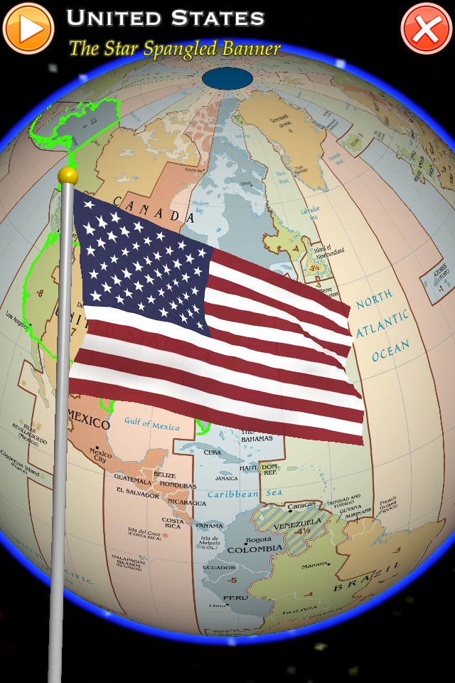

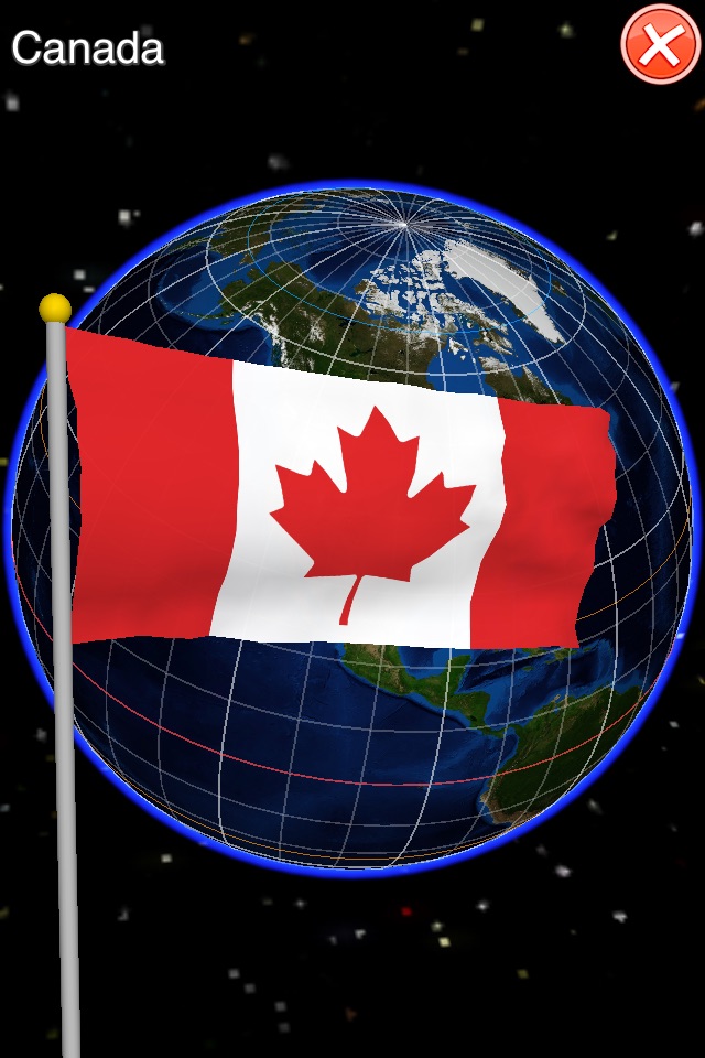

地球を探索するための最も直感的なジェスチャーコントロール。 ISO3166-1は、249の国や地域と米国の50の州が含まれて含まれています。ウィキペディアへのリンクだけでなく、超リアルなフラグ飛んでアニメーションをダブルクリックします。
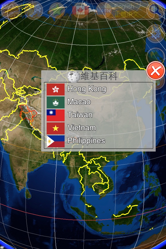
◎ Support Languages: 正體中文, English, 简体中文, 中文(香港), 日本語, Français, Español, Deutsch, Русский, Português, Italiano, Nederlands, Polski, Ελληνικά, 한국어, ภาษาไทย; Area(km²), Capital City, 首都城市.
◎ Display both names with different languages, and adjust font size
----------------
◉ Gesture Control ◉
◎ Tap: focus to center
◎ Double-Taps: link to Wikipedia, or choose flags
◎ Pinch: zoom in/out, rotate
◎ Slide: move viewer
◎ add rotate-north-up toggle
----------------
◉ Feature ◉
◎ World time zone map (with sea, ocean)
◎ High quality texture-maps for 3D earth
◎ 300 Realistic flags by real-time rendering
◎ 220+ national anthems (need to download from internet)
◎ Custom your own anthems(.mp3) in Documents folder via iTunes
◎ Support Landscape and Portrait mode
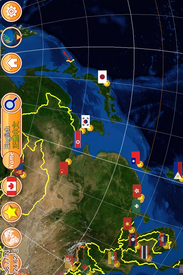
◎ Boundary, name, and flag info (by ISO 3166-1 with 249 countries)
◎ Disputed areas by red-outline
◎ Included ISO 3166-1 alpha-2, alpha-3 code
◎ Included 50 states of USA, United Nations, European Unions, and some geopolitical entities
◎ Longitude/Latitude display (with equator, tropical, and polar)
◎ Smoothly control by gesture: tap, double-taps, pinch, slide
◎ Search tool by name
◎ Show your location on earth
◎ Offline browse is OK. (except to link to Wikipedia)
◎ InAppPurchase: Unlock 2nd name and remove ads
----------------
◉ Special Thanks ◉
◎ Naaty Design, http://www.content-pack.com
◎ Visible Earth, http://visibleearth.nasa.gov
◎ Natural Earth, http://www.naturalearthdata.com
◎ Tom Patterson, www.shadedrelief.com
◎ Bullet Physics Library, http://bulletphysics.org
◎ Wikipedia, http://en.wikipedia.org/wiki/Main_Page
◎ nationalanthems.info, http://www.nationalanthems.info
----------------
◎ Any comments:
http://www.facebook.com/pages/Heres-TaiwanEarth/499163726790748